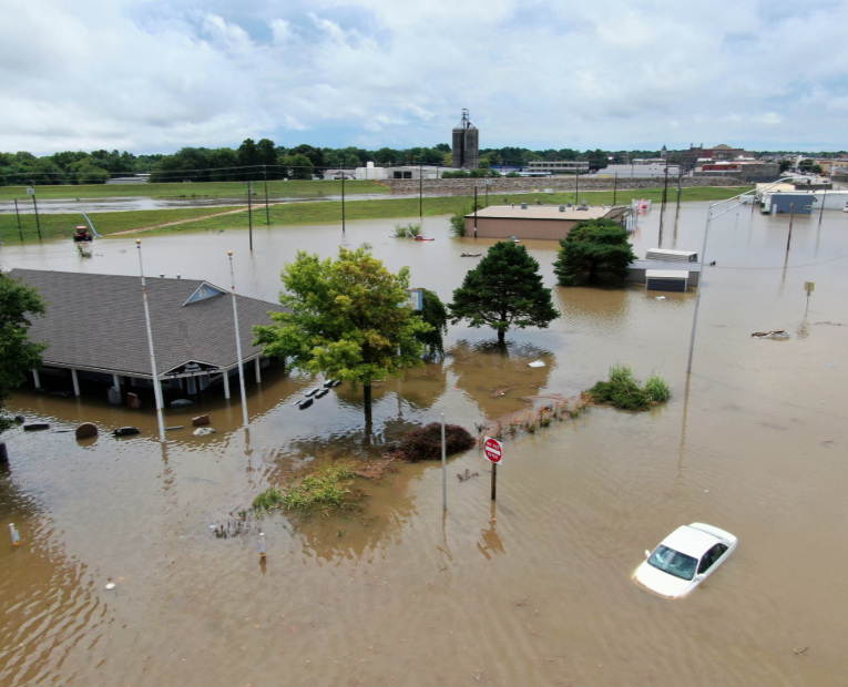
Photo By Twitter/@ottawaksgov
Residents from the eastern slopes of the Rockies and High Plains to part of the Mississippi Valley should brace for multiple rounds of showers and drenching thunderstorms into the weekend.
A nearly stationary weather pattern will set up across the region through the end of the week that will promote the same areas getting hit repeatedly by these thunderstorm complexes.
Moisture from the Gulf of Mexico will be drawn northward into the central Plains on the western side of a high pressure system anchored over the Upper Midwest through Friday. At the same time, a frontal boundary separating cooler and more pleasant air across the Midwest from hot and steamy air in the southern Plains will struggle to move much into the start of the weekend.
It is where the moisture and this frontal boundary collide that flash flooding will become a major concern during the rest of the week.
“Kansas City and much of eastern Kansas, eastern Nebraska and western Missouri will be in the crosshairs of multiple rounds of overnight downpours into Friday,” AccuWeather Meteorologist Brett Edwards said.
The first of these heavy thunderstorm complexes fired up Wednesday night and persisted through Thursday morning, and another similar situation is expected to develop from Thursday night into Friday morning.
As the high pressure over the Upper Midwest exerts its influence farther south and west from Friday into Saturday, the area of heaviest rain is forecast to shift farther south into southeastern Kansas, northeastern Oklahoma and western Arkansas during this time.
“Rainfall totals will average between 2 and 4 inches from eastern Nebraska down into northeastern Oklahoma, southwestern Missouri and western Arkansas,” Edwards added.
Up to a foot of rain can fall in the pattern in some communities. During Wednesday night, more than 10 inches of rain fell on Lone Star, Kansas.
Nearly 7 inches of rain had fallen over Ottawa, Kansas, Thursday morning, all but submerging a portion of the city. A video surfaced of people wading through knee-high water at a local smokehouse to salvage what they could from a barbecue smoker.
The National Weather Service issued flash flood warnings for areas including Ottawa, Kansas, Thursday morning, which lasted into the evening.

